
The National Weather Service extended a Flood Watch through Monday evening, October 5, for much of the Florida Panhandle and Big Bend, southeast Alabama and south Georgia. The Tallahassee office issued the updated watch at 2:34 p.m. EDT Sunday, October 4, replacing the earlier Monday-morning expiration.
Forecasters now expect another 2 to 4 inches of rain across the watch area, with localized totals up to 6 inches possible, especially along the Emerald and Forgotten coasts. The watch means flooding is possible; it is not a Flash Flood Warning, which would mean dangerous flooding is imminent or already occurring in a specific place.
Overnight update, 3:10 a.m. EDT Monday: Localized flooding is now occurring in parts of the region. The National Weather Service issued a Flood Advisory for Quitman County in southwest Georgia until 5:15 a.m. EDT after radar indicated 1 to 3 inches of rain; another 1 to 2 inches was possible. A Flood Advisory signals minor flooding in low-lying and poor-drainage areas. It is less urgent than a Flash Flood Warning.
Forecasters also placed coastal parts of the Florida Panhandle in a Marginal severe-weather risk. A brief waterspout or tornado cannot be ruled out through the night and the low threat may shift toward the Big Bend coast Monday. NWS Tallahassee estimated the tornado chance near 2%, emphasizing that limited instability should constrain the risk. Rainfall rates above 2 inches per hour remain possible in the tropical air mass.
Areas included in the extended watch
In southeast Alabama, the watch includes Geneva and Houston counties. In Florida, it covers all or parts of Walton, Holmes, Washington, Bay, Gulf, Jackson, Calhoun, Franklin, Gadsden, Leon, Jefferson, Madison, Wakulla and Liberty counties or forecast zones.
In south Georgia, the watch includes Baker, Ben Hill, Berrien, Brooks, Calhoun, Colquitt, Cook, Decatur, Dougherty, Early, Grady, Irwin, Lanier, Lee, Lowndes, Miller, Mitchell, Randolph, Seminole, Terrell, Thomas, Tift, Turner and Worth counties.
The National Weather Service said the heaviest rain is most likely near the coast, while south-central Georgia remains vulnerable after repeated heavy rain since Friday. Residents at the western and eastern edges of the region should check their location-specific alert because neighboring National Weather Service offices may use different expiration times.
Expected impacts and uncertainty
Rapid runoff could flood creeks, streams, low-lying roads and poor-drainage neighborhoods. Urban areas are especially vulnerable where repeated downpours overwhelm storm drains. Some rivers may also rise after the rain ends.
Rainfall will not be uniform. The localized 6-inch amount is a possibility where bands repeatedly cross the same area, not a forecast for every community. Locations that miss the heaviest bands may receive substantially less. The weather service may issue Flash Flood Warnings if radar, gauges or reports show that flooding is imminent or underway.
Shoal River Flood Warning near Crestview
A separate Flood Warning is in effect for the Shoal River near Crestview in Okaloosa County, Florida. The warning was issued at 10:19 a.m. CDT Sunday and is valid from Monday evening until late Thursday night.
Minor flooding is forecast. An update issued at 8:48 p.m. CDT Sunday placed the river at 5.6 feet and forecast it to rise above its 8-foot flood stage late Monday evening, crest near 8.4 feet Tuesday morning, and fall below flood stage Thursday morning. At 8.5 feet, water reaches yards along Sowel Road. This river warning applies to the Shoal River near Crestview; it does not mean every community in the larger Flood Watch is flooding.
What residents should do
- Check the latest NWS Tallahassee Flood Watch before traveling.
- People near the Shoal River should follow the latest official river Flood Warning.
- Never drive onto a flooded road. Water depth, current and pavement damage are difficult to judge, especially after dark.
- Keep phone alerts enabled and be ready to move to higher ground if a Flash Flood Warning is issued.
This is a separate event from the Flood Watch for northeast Florida and southeast Georgia, which covers communities farther east along and near Interstate 10.
Sources
- NWS Flood Advisory for Quitman County, updated October 5, 2026 at 3:00 a.m. EDT
- NWS Tallahassee Area Forecast Discussion, issued October 4, 2026 at 8:13 p.m. EDT
- National Weather Service Tallahassee Flood Watch, issued October 4, 2026 at 2:34 p.m. EDT
- National Weather Service Tallahassee Flood Warning for the Shoal River, issued October 4, 2026 at 10:19 a.m. CDT
- NWS Tallahassee forecast office, updated October 4, 2026 at 4:22 p.m. EDT
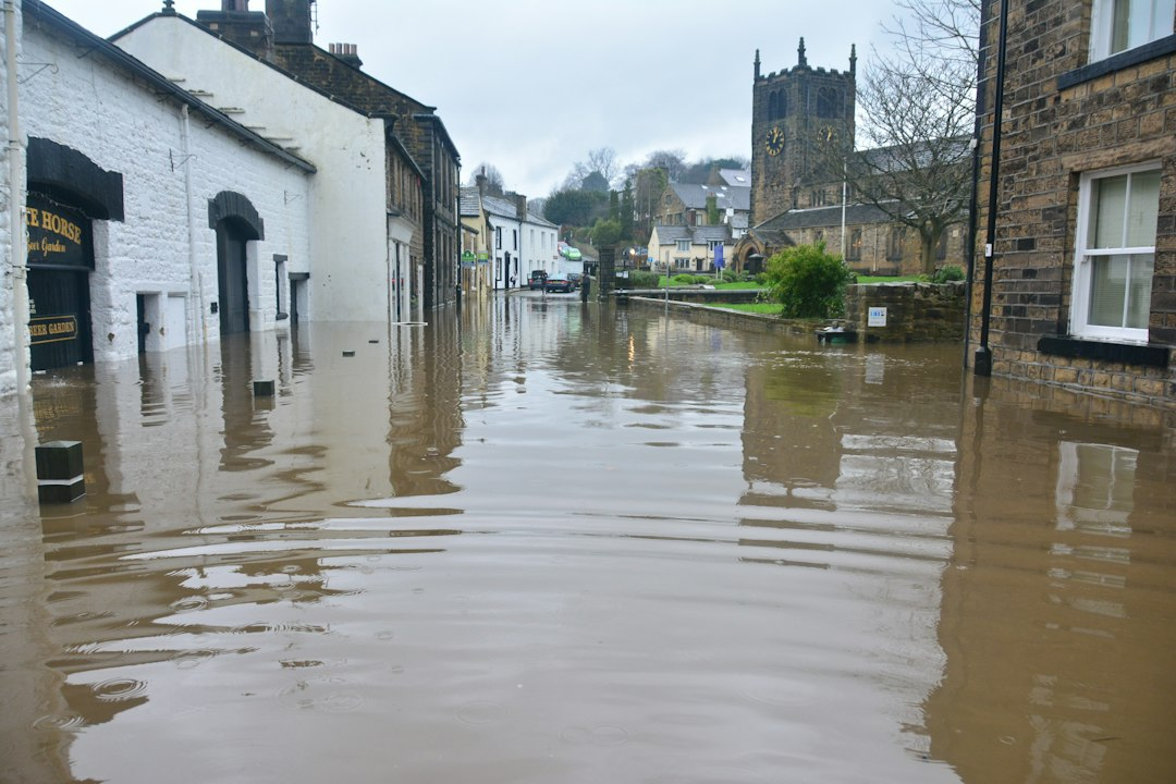
Illustrative photo: flooded street by Chris Gallagher/Unsplash.
[…] part of a broader heavy-rain setup affecting the eastern Gulf Coast. AskNovus is also tracking the Flood Watch across the Florida Panhandle and south Georgia. A watch covers a wider period of potential flooding; the Barbour County warning identifies a place […]
[…] The new Coffee-Dale warning is distinct from the earlier Flash Flood Warning in northern Barbour County. It also sits within the wider heavy-rain pattern covered in AskNovus’s Florida Panhandle and south Georgia flood report. […]
[…] risk for parts of the Southeast. AskNovus has separate background coverage of the broader Florida Panhandle and south Georgia flood threat and the earlier Alabama warning […]