
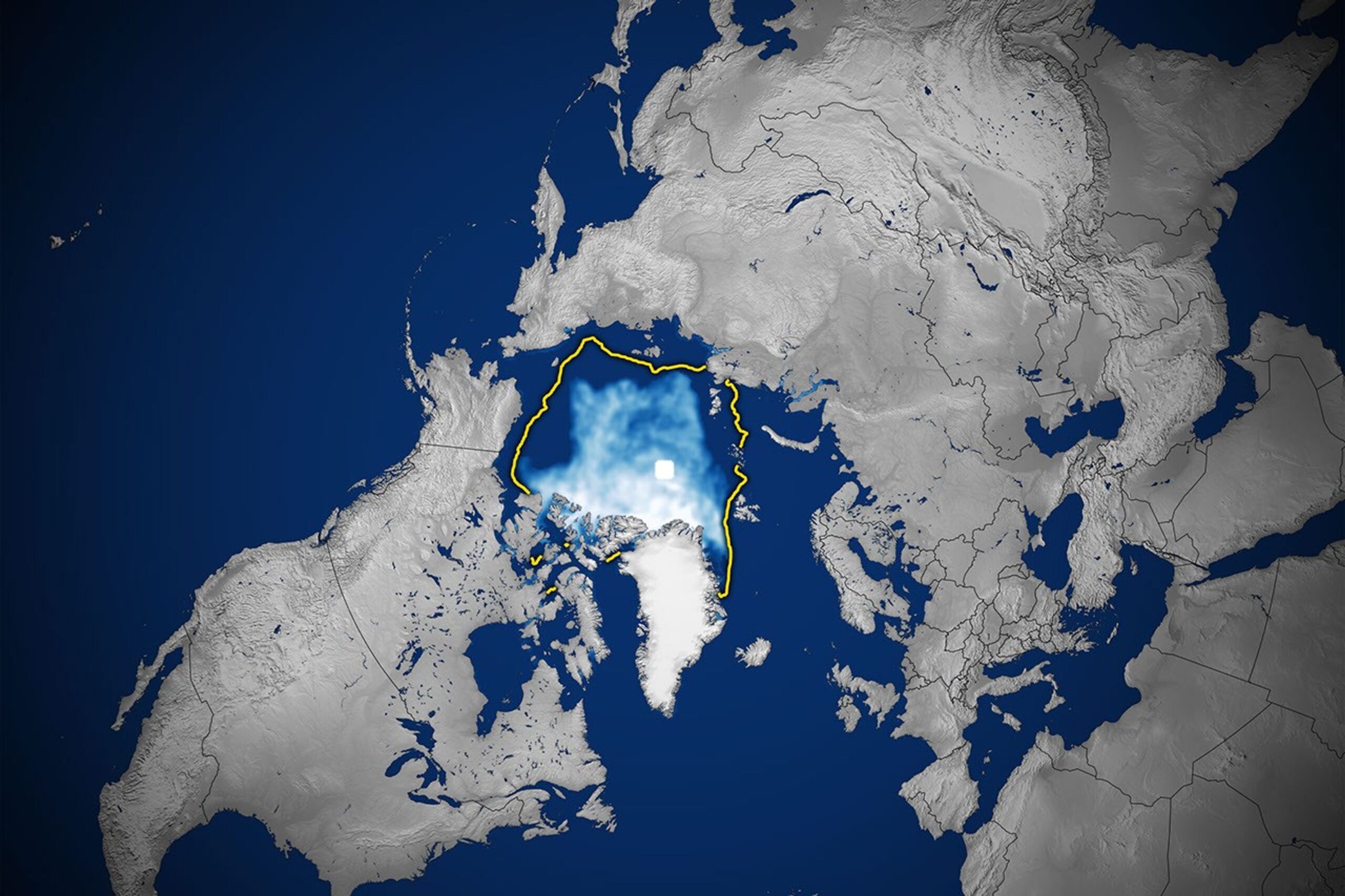
Arctic sea ice reached its likely annual low on Sept. 12, covering about 4.6 million square kilometers, or 1.78 million square miles, according to a NASA Earth Observatory analysis published Wednesday, Oct. 7.
The measurement ties 2008, 2010 and 2025 for the 10th-lowest Arctic summer minimum in the satellite record. It is not a record low, but it remains part of a much longer decline: the 20 lowest summer extents in the record have all occurred during the past 20 years.
What the 2026 minimum shows
Arctic sea ice naturally grows through winter and retreats during summer. Scientists track its extent—the area of ocean with at least 15% ice cover—using satellite microwave instruments that can observe the surface through cloud cover and polar darkness.
The National Snow and Ice Data Center identified Sept. 12 as the likely minimum date. NASA said the 2026 value was roughly tied with three other years for 10th place among the lowest summer extents observed since consistent satellite monitoring began in 1979.
The winter side of the cycle was also unusually low. NASA reported that the March 2026 maximum tied the 2025 maximum for the lowest winter peak in the satellite record. Entering the melt season with less ice, along with a greater share of younger and thinner ice, can make the pack more vulnerable to weather and ocean conditions.
A pause in new records is not a reversal
Recent summer minimums have not set a new all-time record, but scientists caution against reading a short-term plateau as a recovery. Weather patterns, winds and ocean temperatures can create large year-to-year differences. Those variations affect the precise ranking in any single year, while the multi-decade trend remains far below the average extent of earlier satellite decades.
NASA’s analysis says natural variability alone cannot account for the long-term reduction. A smaller ice cover exposes more dark ocean water, which absorbs more sunlight than reflective ice and can reinforce regional warming.
How scientists make the estimate
Researchers combine passive-microwave observations from several satellite missions, including the Defense Meteorological Satellite Program and Japan’s GCOM-W1 spacecraft. They project the measurements onto a grid and add the area of cells that meet the ice-concentration threshold.
The minimum is described as “likely” until scientists have enough subsequent observations to confirm that autumn freeze-up has begun. Brief weather-driven fluctuations can sometimes produce a later low.
NASA Earth Observatory published the Oct. 7 analysis and satellite imagery. The National Snow and Ice Data Center’s Sea Ice Today project provides the ongoing measurements and methodology.
For more research on the changing climate system, follow AskNovus Climate and Science News.
Featured image credit: NASA Earth Observatory/Michala Garrison, using National Snow and Ice Data Center data.